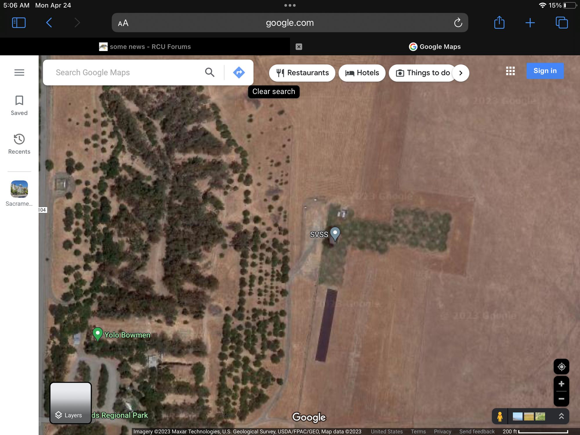
kinda puts a point on the, ya gotta have accurate boundaries and permissions for overflight parts of the fria application.
Like I said on your RCG post. If it were me doing the clubs application I would be as accurate as possible. However if the club has been active in the same location for many years without complaints, if there is an inaccuracy with the boundaries in the application who is going to care/check? IMO in these threads there is a lack of understanding exactly what is happening out in the real world. Doesn�t always align with what is on paper.
If/when there is an accident and said accident occurred outside of submitted boundaries is when someone will care. Likely, it will be the person who DIDN'T care, that WILL end up caring. Pretty important to submit accurate boundaries and assure all users stay within them.
kinda puts a point on the, ya gotta have accurate boundaries and permissions for overflight parts of the fria application.
Nowadays with the modern GPS apps available on smartphones, there is no good reason whatsoever for inaccurate boundary data. Back in the days when it took hiring an expensive Surveyor I could understand small clubs not having the $$$, and using whatever existing data they could find, but what club doesn't have even one member with a smartphone and the smarts to use it?
well, we also have folks in forums that have said that they just put a point in the center of their runway, and draw a (insert size) circle and plan to submit that.
well, we also have folks in forums that have said that they just put a point in the center of their runway, and draw a (insert size) circle and plan to submit that.
In some cases this makes perfect sense. Example, some sailplane exclusive flying sites. Most sailplane fields allow flight 360 degrees from where the pilot stands. I know it�s not quite the same as you mention but if the flying site is remote enough the � one mile radius � could very well work.


 04-18-2023, 08:21 AM